the ourense way
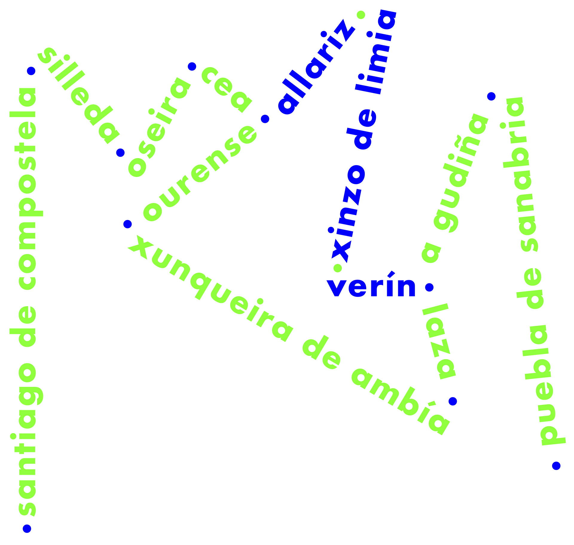
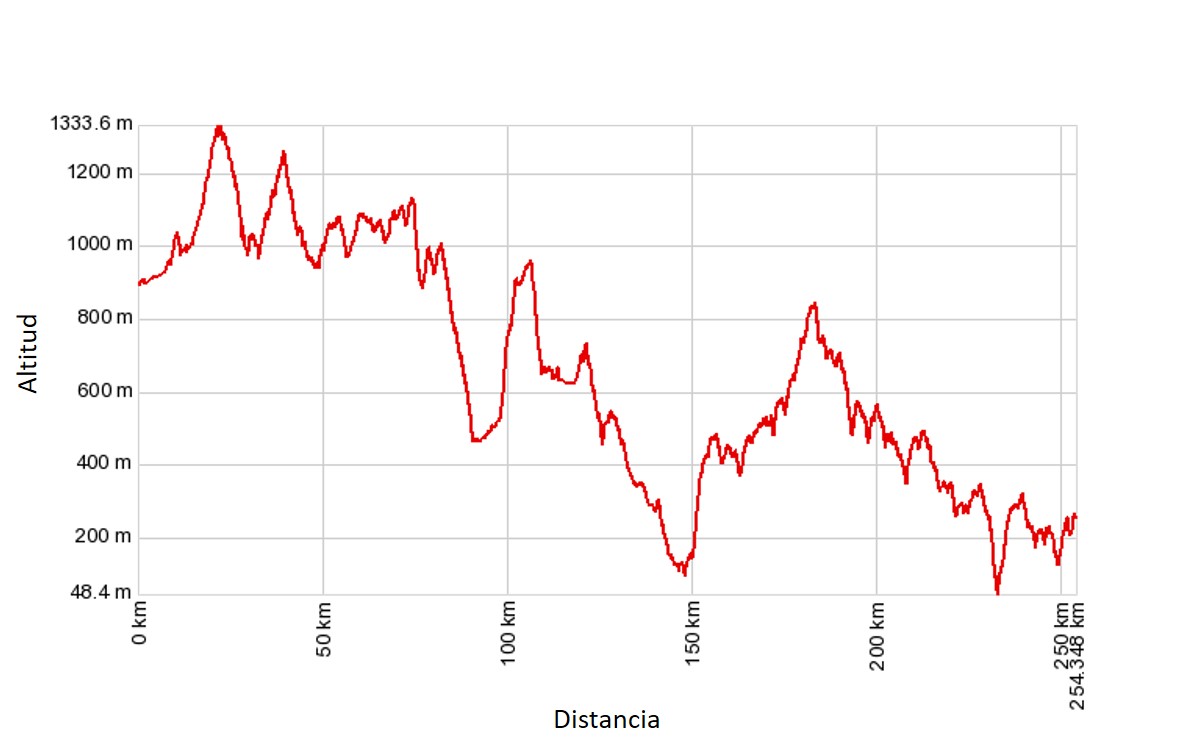
This is the longest Way of Saint James in Iberian Peninsula. Starting from Seville, it extends for some 1,000 km before reaching Santiago de Compostela (even further if we include the various connections with the Mozarabic trails in Andalusia). In Zamora, travellers can take the route towards Astorga along the Silver Trail, before linking up with the French Way, or head for Ourense along what is known in Castile as the Sanabria Way.
We have chosen the name that in our opinion, most appropriately sums up this route. The OURENSE WAY (an extension of the SILVER TRAIL) runs from one end of the province to the other, and also passes through its capital. Between A Gudiña and the city of Ourense, pilgrims can choose between two long itineraries: the quieter, more scenic direct or northern route, passing through the Serra Seca mountains, Laza and Xunqueira de Ambía, or the southern route through the Monterrei, A Limia and Arnoia valleys, dotted with several large towns.
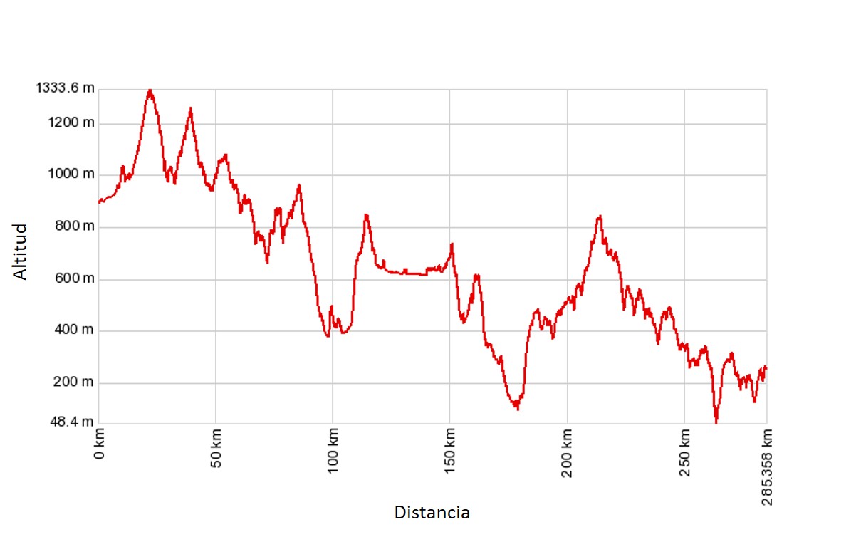
This is one of the lesser-known routes: according to data released by the Pilgrimage Office, in 2019 it accounted for just 2.6% of the total number of pilgrims. Half of those that chose this way set off from Ourense, with the remainder departing from middle-distance towns and cities such as Salamanca, Puebla de Sanabria, Zamora o Granja de Moreruela, or taking the longest route from Seville. Pilgrim numbers on this way appear to have stagnated.
It is true to say that the Silver Trail has earned a reputation as a tough, challenging experience, not merely due to the rugged terrain, but also the long stretches without amenities (particularly in Andalusia and Extremadura) and the relentless heat (in the South from May to October, but also in Ourense during the summer months).
![]() More than any other way of Saint James, the starting point of this ‘ugly duckling’ should be in books, as merely walking is not enough. For it is widely known that “he who reads much and walks far, sees and knows much”. (Don Quixote, Part 2, Chapter 225).
More than any other way of Saint James, the starting point of this ‘ugly duckling’ should be in books, as merely walking is not enough. For it is widely known that “he who reads much and walks far, sees and knows much”. (Don Quixote, Part 2, Chapter 225).
From Puebla de Sanabria the route makes its way through Sanabria, with its characteristic oak and pine forests, passing through the Padornelo and A Canda passes before entering Galicia in the area known as Frieiras (A Gudiña), with a backdrop of majestic, rounded mountains. This is followed by Monterrei Valley and its vineyards, whose capital is Verín, the surprising farming plains of A Limia, the wooded lands of Allariz and Maceda, and the Ourense basin, through which the River Miño flows.
From Ourense, also known as the city of As Burgas in honour of its hot springs, the way crosses the region of O Carballiño towards Santo Domingo hill, on the boundary with the province of Pontevedra. It then makes its way through Terra de Deza, a livestock farming region and the market town of Lalín, before entering the province of A Coruña after crossing the River Ulla, not far from the legendary Pico Sacro mountain. In Galicia alone, this Way is a challenging 215 kilometres in all, to which a further 42 kilometres must be added if you take the route via Verín.
The built heritage includes the ethnographic treasures huddled in the small towns and villages of the province, as well as magnificent historic quarters such as those of Ourense or Allariz, and monumental buildings such as Monterrei Castle or Oseira Monastery.
The ancient paths, which the pilgrims shared with the mule drivers and harvesters journeying to and from Castile, still make up a considerable part of the way, whilst other stretches will take us along farm and forest tracks or mostly minor country roads.
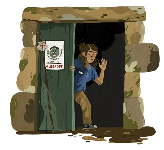
As this is not a particularly busy way, the accommodation offer is sufficient for the time being. In addition to the public hostels, there are other options that charge reasonable rates for pilgrims, due to the relatively low number of tourists. From Ourense onwards, and in particular from A Laxe, where the route joins up with the Winter Way, pilgrim traffic increases, and with it the range of amenities on offer.
Our journey from Puebla de Sanabria will take between 10 and 12 days, plus a further two if we opt for the Verín route. Add another day to explore Ourense, and another in Santiago, and we will need around a fortnight in order to complete the route at a relatively leisurely pace.
 HOW TO GET TO PUEBLA DE SANABRIA
In order to get obtain a proper insight into the Sanabria and Ourense Way, rather than starting from the border between Castile and Galicia, we recommend setting off at least as far back as Puebla de Sanabria, which boasts a magnificent historic quarter. Albeit on a more modest scale, we are convinced that crossing the mountains here would also contribute to the “Saint-Jean-Pied-de-Port effect” which we consider to be an essential part of the experience.
–By train. Completion of the high speed railway line to Zamora has made access from Madrid easier. For the time being, Alvia trains are used for the journey to Galicia. Travelling time is between 2 hours 30 minutes and 3 hours (€23 – €29). For the return journey from Santiago, RENFE operates three direct trains each day. Again the journey takes between two and a half and three hours, with fares ranging from €13 – €28.
–By coach. Up to four frequencies a day from Madrid with Avanza, departing from the Spanish capital’s South Station. The journey takes between 3 hours 45 minutes and 4 hours 45 minutes with fares ranging from €24 – €32. Flix Bus operates a service from Barcelona Sants, via Zaragoza, Logroño and Palencia; the journey takes 10 hours 30 minutes and costs between €40 and €50. There is also a service from Santiago de Compostela via Ourense (not every day). It is operated by Alsa, takes 3 hours and costs €18.
sections
puebla de sanabria – a gudiña
PUEBLA DE SANABRIA-A GUDIÑA STRETCH (53.5 km)
description
The route from Puebla de Sanabria will take us repeatedly along the N 525 roads (including several stretches on the hard shoulder, and across the A 52, under the viaducts and the high speed railway line, feats of engineering yet which have caused serious damage to the Way.
![]() Although the Rías Baixas highway has reduced traffic on the N 525 to a minimum, walking along this main road is far from pleasant. It can even be a harrowing experience when the cars come racing downhill towards you, especially on misty, rainy or snowy days.
Although the Rías Baixas highway has reduced traffic on the N 525 to a minimum, walking along this main road is far from pleasant. It can even be a harrowing experience when the cars come racing downhill towards you, especially on misty, rainy or snowy days.
The walk through the Sanabria region as far as Requejo is easy-going, set against a backdrop of Pyrenean oaks and towns and villages boasting fine examples of traditional architecture. What follows is steady uphill climb to Padornelo (1,357 m) that is not overly taxing, before making our way down to Lubián and the Chapel of A Tuíza.
Camiño en costa, non ten bosta. A popular saying which translates literally as “there is no cow muck on uphill climbs” – the Galician equivalent of “Every cloud has a silver lining”.
![]() There is much confusion surrounding the name of this way: the Silver Trail extended from Merida to Astorga; in the south it was known as the Mozarabic Way, whilst in Zamora the route through Ourense was called the Sanabria Way, and the Galicians unsuccessfully attempted to rename it the South-eastern or Southern Way. The best thing is to keep on walking and not give it much thought…
There is much confusion surrounding the name of this way: the Silver Trail extended from Merida to Astorga; in the south it was known as the Mozarabic Way, whilst in Zamora the route through Ourense was called the Sanabria Way, and the Galicians unsuccessfully attempted to rename it the South-eastern or Southern Way. The best thing is to keep on walking and not give it much thought…
A Canda (1,261 m) is the second peak in this mountain range. It is a gentle climb, and marks the boundary with Galicia. At this point, we finally turn off the main road and embark on a long downhill stretch through O Pereiro Valley as far as Vilavella and O Pereiro. A short climb amongst the gorse brings us to A Gudiña, the first Galician town of any considerable size.
Our suggestions
-Before setting off, take the time to explore Puebla de Sanabria’s picturesque historic quarter. Highlights include the castle of the Counts of Benavente, the Church of the Virgen del Azogue, the walls and the traditional granite houses with their wooden balconies.
-The Baroque Chapel of A Tuíza stands among fields dotted with trees that offer weary travellers a welcome place to rest.
– A Gudiña has few attractions for visitors. Take a walk around the small historic quarter, with the churches of San Pedro and San Martiño, each belonging to a different bishopric, and call in at the Panoramic Area Interpretation and Visitor Centre, which houses an exhibition of local crafts and farm produce. The town is the birthplace of Beatus Sebastian Aparicio, who inspired great devotion in Mexico, and Saint Francis Blanco, martyr of Nagasaki, Japan. Both lived in the 16th century and were members of the Order of Saint Francis.
a gudiña – ourense
A GUDIÑA-OURENSE STRETCH (89 km)
description
When this Galician route was recovered in the 1990s by the Friends of the Way, under the expert guidance of Eligio Rivas, the sculptor Nicanor Carballo made his altruistic contribution to the cause by placing a considerable number of eye-catching stones featuring arrows and symbols related to the Way of Saint James. Many of them remain in place today, accompanying the Galician autonomous government’s official milestones.
The ways fork in A Gudiña’s main square: the most direct route leads off to the right towards the Serra Seca mountain range. We will be captivated by the grandiosity of the vast expanses of empty open land, which once witnessed the comings and goings of mule drivers, harvesters and pilgrims…as well as Manuel Blanco Romasanta, Galicia’s very own wolfman.
As you make your way across Serra Seca, you will be an eye witness to the phenomenon that in recent times the media have referred to as “Abandoned Spain”. The depopulation of villages not only leads to the loss of buildings and settings associated with human activity, but also traditional ways of life, memory and even identity. These empty spaces are filled with mass reforestation and increase the risk of wildfires.
We make our way to Campobecerros across a mountain at an altitude that ranges between 1,000 and 1,100 metres, stopping for sustenance at the inns that provided rest and provisions for travellers: do Espiño, da Cerdeira, da Teresa, do Bolaño. To the north, As Portas reservoir, which drinks from the River Camba, remains constantly within our sights. It is the largest in the province and has a dam rising up an impressive 141 metres. The heather, which flowers in autumn, forms a vast carpet for the land characterised by its poor soil and damaged by fire.
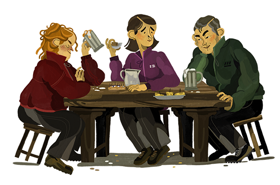
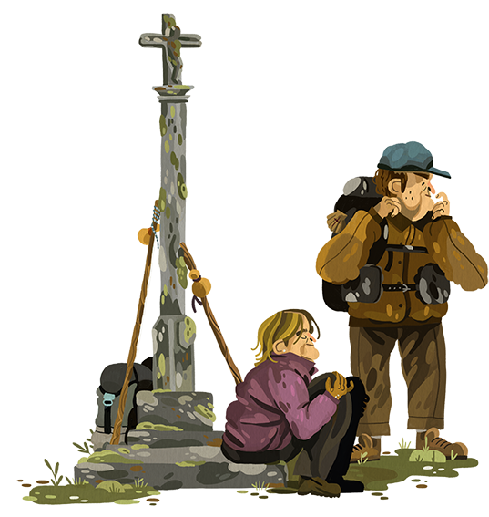
Until we reach Laza, Campobecerros is the only place where we can stop for a meal or spend the night. We make our way through the white gorse known locally uces, up a slope to Portocamba, before embarking on another climb to Camba hill, crowned by the Pilgrims’ Cross. Tradition has it that travellers leave a stone at the foot of the cross in memory of all those that lost their lives whilst completing the Way.
From here we make our way downhill between pine and oak woods to the compact town of Laza. This is also a stop on the official route from Chaves (the Inland Portuguese Way) and Verín, which is also an option for those travelling from A Gudiña to visit Verín and Monterrei.
On leaving Laza, we will notice a radical change of scenery, as we head towards the lofty Támega valley and its verdant trail. From there, we face a steep climb up Requeixal hill as far as the aptly named Alberguería (albergue is the Spanish word for ‘shelter’ or ‘hostel’).
Another wooden cross and shrine mark the highest point in this area, Mount Talariño (970 m), affording views of the Chapel of Os Milagres do Monte Medo, a popular place of worship amongst the locals.
 An arduous trek for even the most dedicated of pilgrims, with long, solitary walks across the Padornelo and A Canda passes, over the Serra Seca mountains and Santo Domingo hill. Less taxing, albeit longer, is the route through the valleys of Monterrei and Limia, on the final stretch to Santiago de Compostela.
We make our way down to the northern section of A Limia. From Vilar de Barrio, we will observe vast expanses of agricultural land where the principal crop is the Kennebec potato. This was also the site of the legendary Antela Lake, which was drained in 1958, although nature has begun its own regeneration of this vast wetland of immense ecological value which extends over an area of some 3,600 hectares.
The striking flatland comes to an end after the village of Padroso, and we must now make our way over a series of rocky crags before heading down to Xunqueira de Ambía, a relatively large town in comparison with those visited so far.
A succession of villages lines the four leagues of the gentle descent that lead us to Ourense. The increasing number of modern buildings indicate that we are fast approaching the city. The itinerary from Verín and Allariz joins our route in As Pereiras.
Before entering the provincial capital, we must unfortunately go through the San Cibrao das Viñas Business Park, before walking up Cumial hill, from where we will catch our first sight of the city.
Before entering Ourense, the well-kept district of Seixalbo is a pleasant surprise. We head for the city centre along Avenida de Zamora and Rúa Progeso, which will bring us to As Burgas hot springs and the Cathedral.
![]() As you will have time later on to visit As Burgas, we recommend you head for the centre from the Possío gardens along a succession of streets: walk straight ahead along Padre Feijóo, Colón, Moratín and Bispo Carrascosa towards the main square, through the pedestrianised historic quarter.
As you will have time later on to visit As Burgas, we recommend you head for the centre from the Possío gardens along a succession of streets: walk straight ahead along Padre Feijóo, Colón, Moratín and Bispo Carrascosa towards the main square, through the pedestrianised historic quarter.
Our suggestions
-Take your time when crossing the la Serra Seca mountain range and experience a journey back into time along one of the most solitary and solemn ways of Saint James. The scenery is on a par with passes in the Pyrenees or Palo Pass on the Primitive Way.
-Don’t miss the chance to visit the Collegiate Church of Santa María la Real in Xunqueira de Ambía, which once formed part of a monastery. This 12th century temple is built in the Romanesque style that was typical of Santiago de Compostela and features three naves, three apses, rose windows and a false triforium. Adjacent to the church is the Late Gothic cloister, which dates back to the early 16th century.
-Instead of quickening your pace, slow down at the entrance to Ourense in order to admire the delightful corners and buildings in Seixalbo. Miraculously conserved in such built-up surroundings, it is listed as a Site of Ethnographic Interest.
a gudiña – verín
ALTERNATIVE ROUTE: A GUDIÑA-VERÍN (40.5 km)
description
![]() This alternative route, unquestionably more urban and monumental in nature than the northern itinerary, has a serious drawback, as much of the way runs along the N 525 road, often on its hard shoulder, and the A 52.
This alternative route, unquestionably more urban and monumental in nature than the northern itinerary, has a serious drawback, as much of the way runs along the N 525 road, often on its hard shoulder, and the A 52.
From A Gudiña’s main square we walk through the town until we come to the N 525, turning off this road in order to walk through the tree-lined Boelle valley. We will feel somewhat trapped between the main road and the highway, although we will enjoy a brief respite as we walk along the banks and meadows of the River Mente.
![]() Stop to admire the castle of Monterrei, Galicia’s foremost fortress, site of the kingdom’s first printing house and the school where our father, Miguel de Cervantes, may once have been a pupil.
Stop to admire the castle of Monterrei, Galicia’s foremost fortress, site of the kingdom’s first printing house and the school where our father, Miguel de Cervantes, may once have been a pupil.
Making our way downhill through Riós, we can stop off for a drink or something to eat in the bars and restaurants of As Vendas da Barreria. The route now takes us northwards through Sarreaus and San Pedro de Trasverea, a landscape peppered with chestnut groves.
Fumaces brings us back to the N 525. From here the Way follows the road practically until we come to Verín. The scenery contrasts sharply with the Monterrei valley and mountains, with orchards and vineyards lying between the spas. We enter this large town via Avenida de Castela, which takes us straight to the River Támega, although the alternative route through the historic quarter is far more recommendable.
Good wine will revive the pilgrim. (Popular saying)
Verín forms a Eurocity cross-border conurbation with Chaves, a Portuguese town standing on the other side of the river, and a stopping point on the Inland Portuguese Way.
![]() In Verín we suggest you follow this route: start in Rúa Rosalía de Castro, initially an earthen track between plots of land. When you come to the historic quarter, walk down Cruz and Maior streets as far as the bridge over the Támega.
In Verín we suggest you follow this route: start in Rúa Rosalía de Castro, initially an earthen track between plots of land. When you come to the historic quarter, walk down Cruz and Maior streets as far as the bridge over the Támega.
Our suggestions
– Verín is a great place for tasting octopus, before taking a stroll around the historic quarter along streets such as Maior, Merced, Lisa, Cruz and García Barbón Square. On the other side of the river, visit the Chapel of San Lázaro and the pilgrims’ hostel known as Casa do Asistente, with its enormous coat-of-arms.
-If you’re not planning to head for Laza the next day, take the time to visit the magnificent Monterrei Castle (a 1.2 km walk). Dating back to the 12th century, it was rebuilt in the 15th century and converted into a palace in the 16th century. Although today it houses a Parador hotel, parts of the castle are open to visitors (from 10.30 a.m. to 7 p.m., closed Mondays and Tuesdays. Admission free), who can admire the 14th century ‘Ladies’ towers and the 15th century keep. Included in the visit is a series of other buildings scattered around the walled enclosure, including the 13th century Church of Santa María de Gracia, and the pilgrims’ hospital which dates back to the 14th century.
verín – ourense
ALTERNATIVE ROUTE: VERÍN-OURENSE (55.7 km)
description
After crossing the Támega, from Verín we make our way up to the medieval Monterrei fortifications before descending the western face of the hill, flanked by vineyards, down to the village of Albarellos, where we cross the river of the same name.
We follow the course of River Albarellos as far as Infesta, where we cross the N 525 before making our way through two villages where time seems to have stood still: Rebordondo and Pena Verde. As Estivadas hill (849 m) separates the Monterrei valley from A Limia, which is reached through Viladerrei and Trasmiras, and several hamlets dotted with sturdy granite houses.
![]() And to fill your belly, the blessed potatoes brought from the New World which are grown with painstaking care and devotion in A Limia, or the delicate almond trees of Allariz, of Hebrew origin, in a feast fit for kings.
And to fill your belly, the blessed potatoes brought from the New World which are grown with painstaking care and devotion in A Limia, or the delicate almond trees of Allariz, of Hebrew origin, in a feast fit for kings.
Tracks laid in accordance with the Cartesian system in the 1950s and 1960s when the Francoist National Institute of Rural Development and Colonisation drained Antela Lake, crisscross the plains that are used mainly for agriculture. Xinzo de Limia nestles in the centre of this area, a large town offering a full range of amenities.
The Cartesian land division continues, yet this time across the wetlands that are slowing regenerating. In Vilariño das Poldras, three original milestones indicate that the Roman Via Nova passed through this site. Shortly after, in Sandiás, we will catch sight of the Church of San Estevo and what remains of its medieval tower, one of four that once stood guard over the plains.
Our arrival in the region of Allariz brings with it an uphill climb, but this time through deciduous woods and the picturesque village of San Salvador dos Penedos and the Couto das Picoutas Nature Reserve. From here we make our way down to Arnoia valley.
Allariz is a haven for culture and heritage, undoubtedly the best conserved town in inland Galicia, and definitely worth a leisurely visit.
Culture is the sum of all the forms of art, of love and of thought, which, in the course of centuries, have enabled man to be less enslaved. (André Malraux)
In Allariz’s industrial estate, and after crossing the N 525 and under the A 52, the Way heads north, passing through several semi-abandoned villages and woods, to Augasantas. This hamlet, with its Romanesque church and several fine examples of traditional architecture, is one of the most interesting on the route. According to the legend of Santa Mariña, a Galician martyr who lived in the 2nd century CE, three springs of holy water began to flow after she was beheaded.
After Augasantas, we pass by the Forno da Santa and Penedo da Moura funerary monuments and the Pre-Roman Armeá fortified settlement. After a short uphill walk we cross the high speed railway line and the River Barbaña before joining up with the main route in Pereiras.
Before entering the provincial capital, we must unfortunately go through the San Cibrao das Viñas Business Park, before walking up Cumial hill, from where we will catch our first sight of the city.
Before entering Ourense, the well-kept district of Seixalbo is a pleasant surprise. We head for the city centre along Avenida de Zamora and Rúa Progeso, which will bring us to As Burgas hot springs and the Cathedral.
Our suggestions
-The Galician potato, the first root vegetable in Europe to be awarded a Designation of Origin, is truly deserving of its excellent reputation. A Limia is Galicia’s principal potato growing region, and Xinzo the centre of this industry. Of course, it’s not a question of simply eating a plate of potatoes, but we strongly recommend any dish that includes them as an ingredient (how about an omelette) or accompaniment (Galician-style octopus with boiled potatoes?).
-If you’re interested in learning more about Ourense’s Entroido or carnival celebrations, which boast a long-standing tradition in Xinzo, Verín, Laza and many other towns and villages throughout the province, call in at the Galician Carnival Museum in Xinzo de Limia, which houses an interesting collection of costumes, masks and posters, amongst other exhibits. It is open from Wednesday to Saturday from 10 a.m. to 1.30 p.m. and from 4 p.m. to 6.30 p.m. On Sundays it is open in the morning only.
-A tour of Allariz’s historic quarter, winner of the 1994 European Urban Planning award, is guaranteed to be a truly memorable experience. 1. A good place to start is Campo da Barreira, site of the Baroque Chapel of San Bieito and the Monastery of Santa Clara, which houses the largest cloister in Spain and intriguing ivory figure of the Virgin Abrideira in its museum; 2. Wander around the cobbled streets of the historic quarter, admire the Romanesque churches of Santiago and Santa María de Vilanova, the castle ruins and visit the toy and fashion museums; 3. Stroll along the banks of the River Arnoia, with its double arched medieval bridge, enjoying the tree-lined riverside walk and gardens and exploring several renovated mills and tanneries; 4. Round off the experience by tasting some of the delicious local produce which can be purchased in specialised stores, and in particular the local artisanal cakes and pastries (amendoados, torta real, melindres).
Between mid-May and mid-September, visitors to Allariz will be able to admire the entries for the International Garden Festival, which each year is based on a different theme.
–Santa Mariña de Augasantas is one of the most fascinating places in Galicia. After visiting the 12th century Romanesque church, reminiscent of the one in Xunqueira de Ambía, the Way takes us close to Armeá. There, nestling below a Pre-Roman fortifies settlement and under the foundations of the Gothic Basilica of La Ascención, is a vaulted crypt housing the Forno da Santa, a Pre-Roman funerary monument featuring a crematorium, monolith and pool.
all about ourense
WHAT TO DO IN OURENSE
description
The early bird may catch the worm, but the second mouse gets the cheese.
[está mal visto detenerse, como si de holgazanes fuera el oficio y una pérdida de tiempo, pero en el Camino una parada puede enriquecerte]
Must-dos for pilgrims
-You can stamp or obtain your pilgrim’s passport in the Cathedral (Tel. + 34 988 220 992) or at the Friends of the Way Office (Praza das Damas, Tel. + 34 988 391 110).
-Although you choose not to spend the night there, it’s well worth taking the time to visit the pilgrims’ hostel, housed in a building close to As Burgas and one of the finest included in the public network.
Not to be missed
–As Burgas. These hot springs, which were used by the Romans, are the city’s leitmotif. The most famous is the Neo-Classical Fonte de Abaixo, with a flow of 300 litres a minute and a temperature of 67º. In fact, the water is so hot that it was formerly used to blanch chickens.
–Cathedral and the Holy Christ. 12th and 13th century buildings with three naves and a Renaissance ambulatory. As you may not have the opportunity to admire the Portico of Glory in Santiago, take advantage of the chance to take a close look at the Portico of Paradise. Sculpted in the 13th and 14th centuries, it takes its inspiration from the portico in Santiago Cathedral, which conserves its bright polychromy. The most important object of worship is housed in the elaborate Baroque Chapel of El Santo Cristo: a crucifix commission in the 15th century by Bishop Pedro Mariño, who was born in Fisterra, a copy of the cross that is worshipped at the end of the Way.
–Roman bridge. Despite its name, only the foundations remain from that period, and its current appearance of this seven arch bridge is the result of medieval and later modifications and repairs. The central arch spans 38 metres. We will cross this bridge on our way out of the city.
Our suggestions
-Although it no longer houses the public hostel, we strongly recommend a visit to the former Convent of San Francisco to admire its Gothic cloister. Built in the 14th century, it is the finest cloister in Galicia, with 63 arches and 120 capitals.
-Your visit may not coincide with the Christmas season, but in the Chapel of San Cosmede y Damián you can marvel at the Nativity Scene created by the sculptor Arturo Baltar. The figures represent Galician country life. Visiting times are from Monday to Friday from 12 noon to 2 p.m.
-Stock up on provisions at the food market, located next to As Burgas. And if you’re visiting on the 7th or 17th of the month, a street market is held at the fairground (on the opposite bank from the city centre, next to A Chavasqueira hot springs and the River Miño). There you will be able to taste typical dishes such as Galician-style octopus and char-grilled meat, enjoying a leisurely meal in the covered eating areas.
– Bathe in the outdoor hot springs. Situated right in the city centre, next to the public hostel, admission to the As Burgas hot spring is free of charge and includes a wet sauna. (Lockers are available, and the opening times are from 10 a.m. to 1 p.m. and 5 p.m. to 9 p.m. Closed Sundays). Next to the River Miño you will find the Japanese-style Outariz hot springs, which are also free (every day from 10 a.m. to 7 p.m.) and other smaller springs such as Muíño da Veiga. In 2019, a fire destroyed the A Chavasqueira hot spring and rebuilding work has yet to commence. A train will take you from the main square to Outariz (a 7 km journey, costing €0.85). Remember to take your swimwear, flipflops and a towel.
-Plan a tapas session in the bars and taverns that line the streets between the Cathedral and Praza do Ferro square, a bustling microcosmos. An ideal way of tasting classic delicacies (pig’s ear, tripe, pork shoulder, octopus, calamari, mussels, cod and omelette) as well as other more imaginative and avant-garde culinary creations.
-Visit the Café Latino, a shrine to jazz music. Even though you may not be lucky enough to enjoy a live performance, most frequent in spring, you will be able to listen to some fabulous music in one of the city’s classic venues.
ourense – silleda
OURENSE-SILLEDA STRETCH (62 km)
description
Pilgrims have a choice of two routes from Ourense to A Casanova, situated just outside Cea: the first follows the Costiña de Canedo, a route that was created by the Friends of the Way association in the 1990s, and the second via Tamallancos, which is closer to the N 525 and adds an extra kilometre to the journey. Both options take us through wooded areas, include a 400 metre climb out of the Miño river basis, and have sufficient amenities for pilgrims, which means that the decision is entirely a question of choice.
A) Via Tamallancos. After crossing the bridge, we continue along Avenida de Santiago, past the railway track and avoiding the N 525 before tackling the climb up the royal road through Cudeiro, which offers us magnificent views of Ourense. From here we will find paved and earthen tracks through wooded areas. In Tamallancos, which is a well-kept village with a manor house, we cross the River Barbantiño over Ponte Sobreira, a medieval single-arched bridge. The route then continues through Faramontaos and Viduedo, where we should look out for the large coat-of-arms on the manor house wall, running parallel to the main road as far as A Casanova.
B) Via Canedo. After crossing the Roman bridge we turn left into Avenida das Caldas, past the railway station, parallel to the N 120 road and the River Miño. This gentle stroll comes to an abrupt end with the start of the famous Costiña de Canedo, literally ‘the little slope’ – a tongue-in-cheek reference to what is really a challenging 2 km uphill climb along a tarmacked surface. Far easier is the section through the area known as Chaos de Amoeiro, which leads from the village of Cima da Costa through pine and oak forests. The medieval Ponte Mandrás bridge over the River Barbantiño brings us to A Casanova.
![]() O Reguengo lies between Cima da Costa and Ponte Mandrás. Here, César, the landlord of Rincón Telaraña, also known as Parada del Peregrino or Pilgrims’ Rest, serves a glass of wine and something to eat on the house to all those that call in (donations accepted). An authentic classic.
O Reguengo lies between Cima da Costa and Ponte Mandrás. Here, César, the landlord of Rincón Telaraña, also known as Parada del Peregrino or Pilgrims’ Rest, serves a glass of wine and something to eat on the house to all those that call in (donations accepted). An authentic classic.
Both routes converge just before Cea, the principal town of the municipality, famous for its delicious bread.
…bread and wine are important products of culture, they do express a vital human striving. They represent a definite cultural achievement which is the fruit of attention, patience, industry, devotion and laborious toil. (Carl Jung)
On leaving Cea, just after the vast Chapel of La Virgen de A Saleta, built in 1908, the way forks once again:
A) The royal road lies to the left, a shorter option and similar to the one that brought us to Tamallancos. It consists of mostly forest tracks, although it also passes through a number of villages and the capital of the borough of Piñor. On leaving O Reino, we have to cross the N 525 and A 53 roads, which is something of a nuisance, although we later climb uphill through a quieter and solitary area, crossing into the province of Pontevedra before making our way down to Castro Dozón.
B) And to the right, the Oseira route, adding a further 4.5 km to our journey and including solitary stretches over the hills, but which also gives us the opportunity to admire its monastery. From Oseira, we follow a narrow path along the bank of the emerging River Arenteiro and cross the walkway. A steep uphill climb brings us to the top of a hill before we continue through the area known as Terra de Deza. A second climb brings us into the province of Pontevedra and a track lined by oak, chestnut and pine trees leads to Castro Dozón, the small capital of the first borough.
The way once again converges into a single route, running close to the main road. A taxing climb brings us to the top of San Domingos (736 m), site of a chapel dedicated to the preacher Saint Dominic, before a steep downhill walk. This is a kingdom where the pig reigns supreme; indeed, pork is inland Galicia’s greatest delicacy, and for many years now Lalín and its delicious pork stew or cocido have been its finest exponent.
If pigs could fly, no bird would equal them. (Popular saying)
We make our way through the ancient hamlet of Pontenoufe, where we cross the river Asneiro and the high speed railway line twice. We then come to the tunnel and the Botas-Lalín station, which stands on the now abandoned former railway line.
The next sight to look out for is the Baroque church in Donsión, with its excessively ornate monumental stone cross. Just a short distance further on, in A Laxe, our route joins up with the WINTER OR SIL WAY, which has brought pilgrims from Lalín, a bustling town offering an alternative option for spending the night (4 km from the station).
The walk down to the River Deza through autochthonous woods and past a cheese factory, is one of the most scenic on the entire route. An ancient single-arched bridge which, according to the inscription, dates back to the year 912, is the oldest of the four cross the river in Ponte Taboada. It was here that the historical Terra de Trasdeza region began.
Taboada church, with its striking Romanesque door, stands next to the main road. The route into Silleda inevitably takes us around the perimeter of the business park, although later we can feast our eyes on the magnificent Trasfontao oak wood, before entering the modern town from the south.
Our suggestions
-No one should leave Cea without tasting its crafted bread and seeing for themselves one of the 16 traditional wood-fired ovens where it is baked. Forno Lodeiro is one such bakery, which also has its own museum. Cea bread, holds a Protected Geographical Indication quality seal. It must be made with a minimum of 50% locally produced wheat and traditional techniques dating back to the Middle Ages are used for the kneading, fermentation and baking processes. You can buy a loaf and keep it in your backpack, as it will remain fresh for several days.
-If you opted for the Oseira route, take your time to fully discover the Monastery of Santa María. Together with the monasteries of Sobrado dos Monxes (on the North Way) and Samos (on the French Way), this is one of Galicia’s largest monasteries where community life continues today. In addition to the 12th and 13th century church, a fine example of Cistercian sobriety, with the exception of the façade, a later Baroque addition, highlights include the magnificent sacristy, with its superb lierne vault ceiling. The monastery rooms are grouped around three cloisters: the 16th century Processional and Pinnacle cloisters, and the 18th century Knights cloister. The monks produce a liqueur called Eucaliptine, made with eucalyptus leaves and other medicinal plants; good for you when drunk in moderation, but any excesses will go straight to your head.
-In Silleda don’t forget to treat yourself to the delicious ring-shaped pastries which have been baked and sold at the Tábora confectionery store since 1870. Other house specialities include the melindres (anisette flavoured pastries) and galeguiñas (cream, cacao and butter biscuits), as well as apple puffs and almond tarts.
silleda -santiago
SILLEDA-SANTIAGO DE COMPOSTELA STRETCH (40.5 km)
description
The rolling lands of Terra do Deza are home to the largest pig and cattle herds in Galicia, as well as the vast agriculture and livestock exhibition site in Silleda.
Perhaps due to its placid and docile gaze, the Galician writer Castelao chose the cow as his symbol of peace, an animal that undoubtedly boasts a more distinguished service record than the dove.
We leave town via the N 525, which we will come across several times before coming to the Nudesa factory, where we turn off the road to head southwards along the delightful path that crosses the River Toxa at A Ponte da Pedra. Shortly after, we pass the N 640 road to Villagarcía de Arousa, and then the AP 53, before entering Bandeira, a frankly nondescript village.
We then head downhill, keeping the main road to our north, through Vilariño and past the 12th century Romanesque Church of San Martiño de Dornelas, with its semi-circular apse. In the distance we will see the Pico Sacro summit, an indication that we are nearing our destination.
A long walk through the woods brings us down to O Castro, whose name indicates that this was once the site of a Pre-Roman settlement. There is a steep incline down to the River Ulla, which to the east affords us a spectacular view of the sheer rocky San Xoán da Cova face, and the two railway viaducts that cross it.
We cross over the Ulla, which marks the boundary with the province of A Coruña. A monument to the camelia welcomes us to the fairly well-kept village of Ponte Ulla. We should also look out for the ancient capital attached to a house, depicting the miracle of Saint Nicholas saving three pilgrims about to be boiled alive.
Our steps now turn northbound along the Illa, past the Villa Alegre manor house and crossing yet again the main road as far as Outeiro. Here, in addition to the Chapel of Santiaguiño and a Baroque fountain dating back to 1676, with an inscription that refers to the legend of the Pico Sacro mountain peak, there is an excellent public hostel.
Indeed, on approaching the foot of the hill, an enormous dragon suddenly emerged from its cave…breathing fire at the holy men of God, in a threatening manner, putting their lives in danger. (Book III, Codex Calixtinus).
A large forest, where the eucalyptus has put an end to any serious competition from other species, brings us to Lestedo, site of a monumental cruceiro or stone cross, and Ruibal, with its manor house. We are now practically on the outskirts of the city, and the landscape becomes increasingly built-up, lined with modern housing dotted between farmland.
Instead of following the historic route, with the beautiful medieval Busacos bridge on the other side of the N 525, the Way crosses the River Saramo into A Susana. Shortly after, Vixoi marks the start of the municipality of Santiago de Compostela, pleasantly surprising us with its charming bridge and Chapel of Santa Lucía.
A penultimate uphill climb takes us first under the AP 9 motorway and past the fateful bend in Angrois, site of a tragic railway accident in 2013, as far as Piñeiro. It is here that we will catch our first glimpse of the imposing City of Culture, situated nearby, and in the distance, the city of Santiago de Compostela and the Cathedral towers.
We make our way down along the Sar road, past the Romanesque collegiate church. It is well worth stopping for a moment to enter the temple and observe the intriguing leaning pillars. Walking up towards the historic quarter along Rúa Castrón Douro, we come to Mazarelos and the only surviving gate of the former city wall. We continue on our way, through Universidade, Caldeireiría and Xelmírez squares, which will eventually bring us to another square, Praza de Praterías, and the Cathedral.
Our suggestions
– The railway viaducts over the River Ulla are a spectacular feat of engineering and nature. Perched on top of the sheer granite face was the Monastery of San Xoán da Cova. In the 20th century it underwent a radical transformation with the construction of the first bridge. Work on the bridge concluded in 1956, and happily, the stone-cladding of the metal structure blends in perfectly with the setting. A second viaduct was built in 2008, this time for the high speed railway line. It received the 2011 San Telmo Prize, awarded by the Spanish Institute of Civil Engineers. Inspired by the original viaduct, it is 630 metres long and 117 metres high, making it the highest railway viaduct in Spain.
-With an altitude of 535 metres, Pico Sacro is an emblematic landmark for several reasons. Legend has it that this is Mount Ilicino, where the disciples of Saint James, tricked by Queen Lupa, travelled to yoke the oxen to the cart that would carry the Apostle’s body. Yet, in fact they were wild fighting bulls, and they were also first forced to defeat the dangerous dragon that dwelt there. The peak was crowned by a fortified tower, and there is also a mine opening, known as the Calle de Doña Urraca, and the Chapel of San Sebastián, making this a holy site. Popular belief has it that the pure quartz inside that mountain and that brought miners to the area also attracts the sun’s rays. Tradition says that if the peak is shrouded in clouds, rain will follow. It is almost 2 kilometres off our route, but on the way we will find a Visitor and Interpretation Centre as well as a Tourist Information Office. If you are spending the night in Outeiro it is well worth a visit, because in addition to the fascinating tales associated with this legendary site, you will also be able to catch your first glimpse of the Cathedral towers.
-As has become your custom along the Way, take a restorative break in the Chapel of Santa Lucía, dating back to 1829. A delightful oasis boasting a river, bridge, fountain, mill, stone cross, a paved path and shady trees.